A prolonged coastal flooding event continues across the Outer Banks on Monday, with additional overwash and flooding expected during this afternoon’s high tide, particularly for areas north of Cape Hatteras, according to the National Weather Service (NWS) Newport/Morehead City office.
N.C. Highway 12 from Oregon Inlet to Rodanthe and on northern Ocracoke Island remains closed on Monday morning, however, North Carolina Department of Transportation crews are continuing work to clear the roadway.


A Coastal Flood Warning remains in effect for Hatteras Island, where 2 to 4 feet of inundation above normally dry ground is possible around the 1:00 p.m. high tide. Conditions will improve slowly through the week, but impacts are expected to linger into Tuesday.
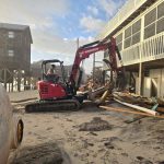
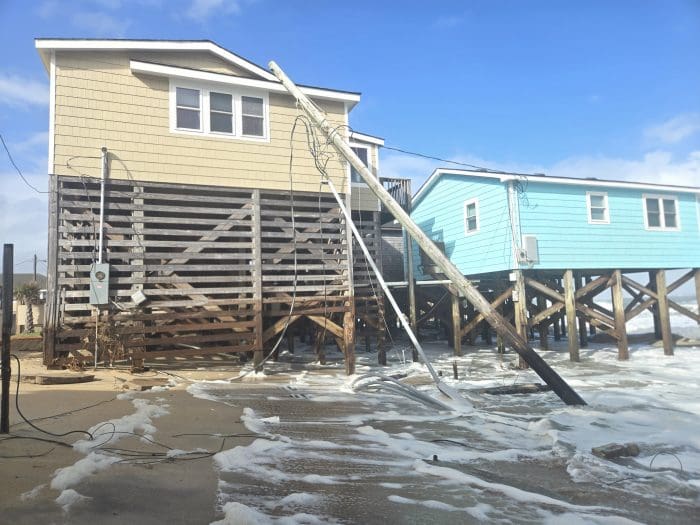
Damage to nearby oceanfront structures is also possible, particularly in areas where dunes have been weakened by days of heavy surf and high water.
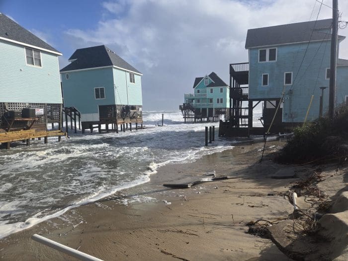
Minor to moderate soundside flooding is expected to continue from Avon south to Ocracoke Village, with 1 to 2 feet of inundation possible through at least Wednesday as strong northerly winds persist. The extended period of elevated water levels will affect both the oceanside and soundside, with gradual improvement midweek as winds diminish.
The NWS notes that this afternoon’s high tide represents the final significant flooding threat of the ongoing event, but elevated water and hazardous surf will persist into Tuesday.
Residents and visitors should avoid travel through flooded roadways and continue to monitor official updates. Coastal flood advisories and road conditions can be tracked at weather.gov/mhx and DriveNC.gov.
The post Coastal Flooding Continues Today; Additional Impacts Expected Around Afternoon High Tide appeared first on Island Free Press.

 Add to favorites
Credit: Original content published here.