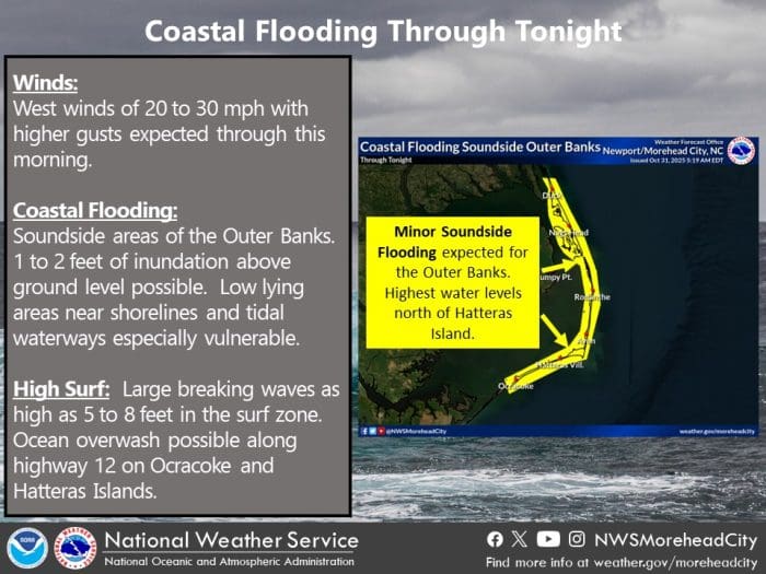
Minor soundside flooding and pockets of ocean overwash are possible along the Outer Banks on Friday, even as clear skies and fall temperatures dominate the forecast, according to the National Weather Service Newport/Morehead City office.
A westerly wind on Friday morning, with gusts up to 30 mph, is expected to push water into soundside areas from Ocracoke north through Hatteras Island and into the northern Outer Banks. Water levels of 1 to 2 feet above ground level are possible in low-lying areas near the sounds and tidal creeks.
Forecasters noted that the highest soundside water levels are expected north of Hatteras Island, but vulnerable spots on both Hatteras and Ocracoke Islands may still see standing water, particularly in areas that routinely experience soundside flooding.
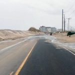
Meanwhile, large swells generated by Hurricane Melissa, which remains well offshore, will continue to impact the local surf zone. Breaking waves of 5 to 8 feet could lead to isolated ocean overwash, especially along N.C. Highway 12 on Hatteras and Ocracoke Islands near times of high tide.
Despite the coastal hazards, the core weather pattern is improving. Skies are expected to stay mostly sunny, with afternoon highs reaching the low to mid-60s, making for a clear fall day across eastern North Carolina once winds ease later in the day.
Travelers along N.C. Highway 12 should use caution, avoid driving through saltwater, and monitor updates as conditions may change.
N.C. Highway 12 on Ocracoke remains closed on Friday morning as North Carolina Department of Transportation crews continue work to clear the road.
For local weather advisories and updates, visit weather.gov/mhx.
The post Minor coastal flooding, overwash possible on Outer Banks today appeared first on Island Free Press.

 Add to favorites
Credit: Original content published here.