Ocean overwash was reported in northern Buxton and northern Ocracoke Island on Sunday morning, several hours before the noon high tide, with standing water observed north of Hatteras Village and throughout Pea Island.
Additional flooding is expected as the midday high tide approaches. N.C. Highway 12 remains closed on Ocracoke Island, and all ferry service is suspended due to unsafe conditions.
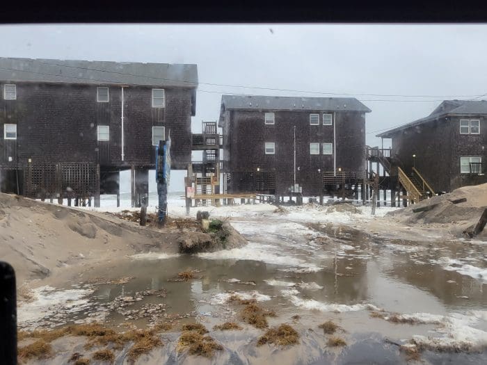
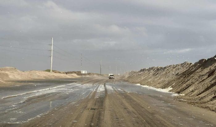
Minor to moderate structural damage was also reported in Buxton for several oceanfront homes. The public is advised to avoid the area as unsafe debris washes ashore and additional damage is likely.

A powerful coastal storm continues to batter the Outer Banks on Sunday with strong northeast winds, flooding, and hazardous surf expected to peak around the midday high tide, according to the National Weather Service (NWS) Newport/Morehead City office.
In its final Sunday morning briefing, the NWS reported that Storm Warnings are now in effect for all coastal waters and the Pamlico Sound, while High Wind Warnings cover the Outer Banks from Down East Carteret County north through Duck. Coastal impacts, including ocean overwash and beach erosion, are expected to be most severe today and will linger into early this week, with conditions improving slowly by midweek.
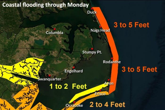
Dare County Emergency Management Director Drew Pearson said Sunday morning that water levels have risen beyond earlier forecasts. “Inundation levels are now three to five feet—an increase from two to four,” Pearson said.
The most likely time of oceanside flooding is around high tide on Sunday, which is roughly 12 p.m.
Northeast winds of 30 to 40 mph with gusts up to 60 mph are expected through mid to late afternoon, coinciding with the most dangerous period of the storm.
“Those along the oceanfront should remain ready to protect property, especially in areas with vulnerable or non-existent dune structures,” Pearson said. “Rain, strong gusty winds, blown sand, high surf, and the increasing potential of ocean overwash on NC 12 will keep travel conditions challenging at best.”
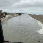
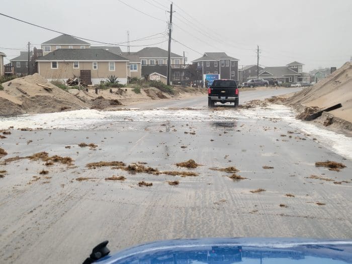
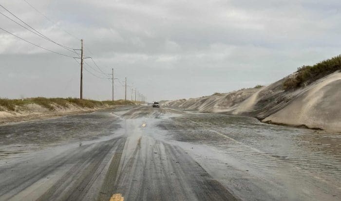
The National Weather Service cautioned that flooding and road closures are likely in areas affected by ocean overwash, especially along Hatteras and Ocracoke Islands, where portions of N.C. Highway 12 may become impassable.
Dare County Emergency Management advised residents and visitors to stay off the roads if possible, as conditions on Highway 12 are expected to deteriorate before, during, and after the midday high tide. Those who must travel should anticipate flooding and potential closures, drive with extreme caution, and yield to NCDOT crews who are working in hazardous conditions to keep the highway clear and safe.
“If you must travel, expect flooding and road closures, and be ready to turn around,” said Pearson. “The NCDOT road crews are working hard to keep things safe. Please give them a ‘brake’ as they work under demanding conditions.”
N.C. 12 remains closed on northern Ocracoke Island on Sunday.
The NWS reports that seas remain extremely hazardous, with large breaking waves capable of causing beach erosion and damage to structures. A High Surf Advisory remains in effect from Cape Lookout north through Duck.
Mariners are strongly advised to avoid offshore travel until winds and seas subside. Gale- to storm-force conditions on the Pamlico Sound and adjacent waters will persist through late Sunday.
The NWS also noted that heavy rain and localized flash flooding remain possible, with 2 to 4 inches of rainfall expected along the coast and locally higher totals possible in heavier rain bands.
Conditions are expected to gradually improve Monday into Tuesday, but residual flooding and beach erosion will continue into early week. Coastal residents are advised to continue monitoring local forecasts and exercise caution around high-tide cycles.
For the latest local weather updates, visit weather.gov/mhx, and for real-time road conditions, visit DriveNC.gov.
The post Ocean overwash reported ahead of Sunday’s noon high tide appeared first on Island Free Press.

 Add to favorites
Credit: Original content published here.