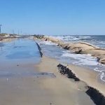
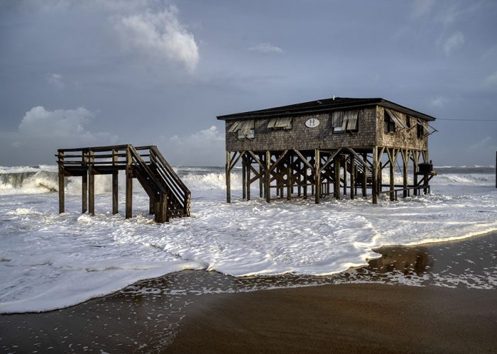
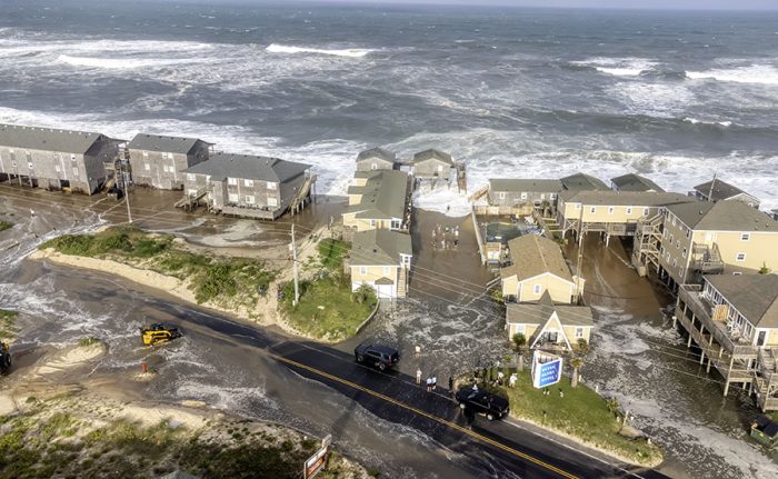
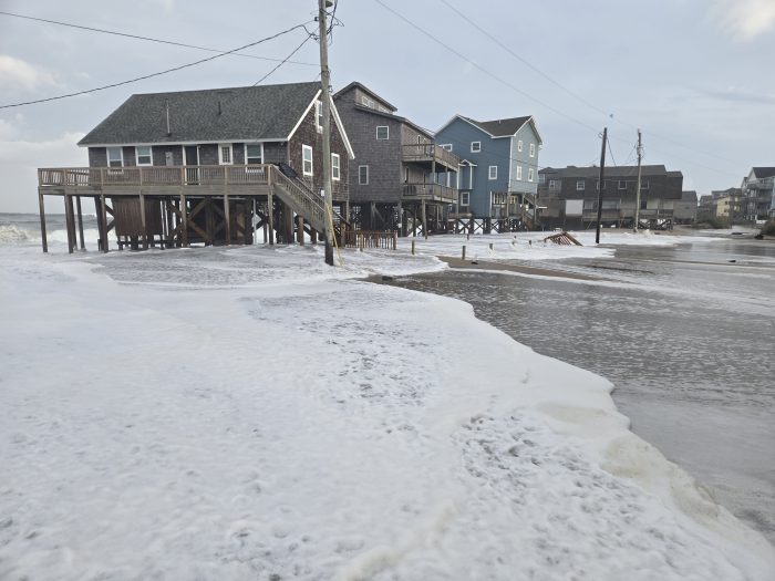
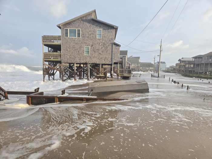
10:00 A.M. UPDATE: Extreme ocean overwash was reported in northern Buxton, north of Hatteras Village, and northern Ocracoke Island with Thursday morning’s high tide. Soundside flooding also inundated Hatteras Village. N.C. Highway 12 remains closed with no current estimate for reopening, according to an update from the North Carolina Department of Transportation.
While Erin is moving northeast away from the North Carolina coast on Thursday, another significant round of ocean overwash should be expected with Thursday evening’s high tide.
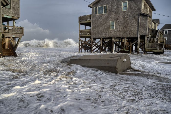
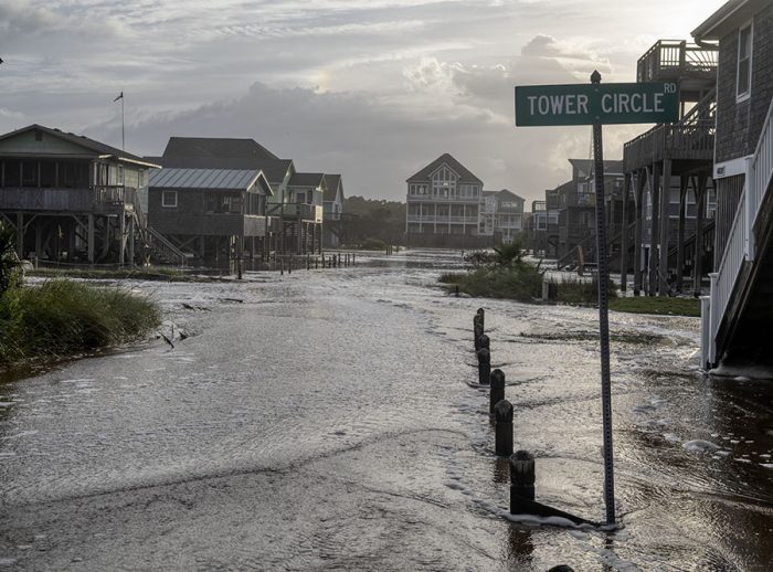
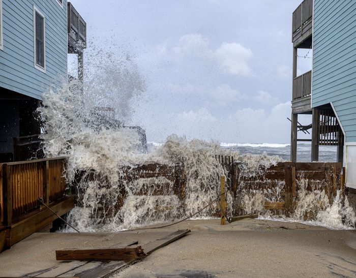
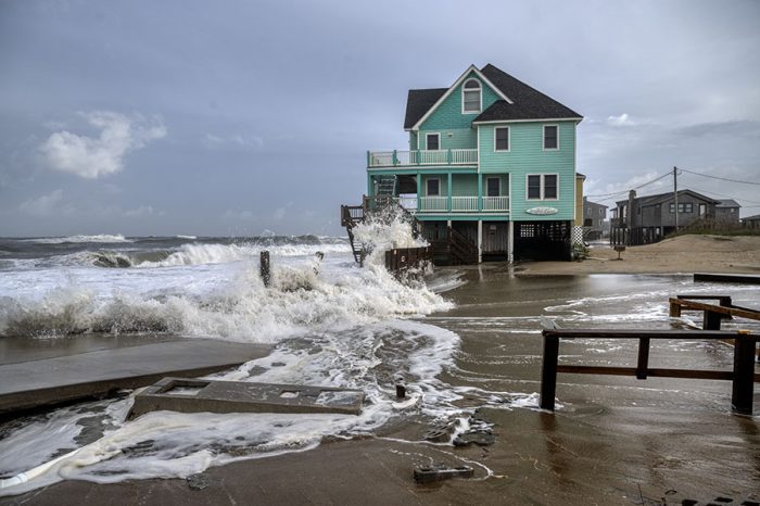
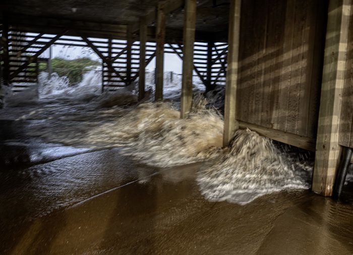
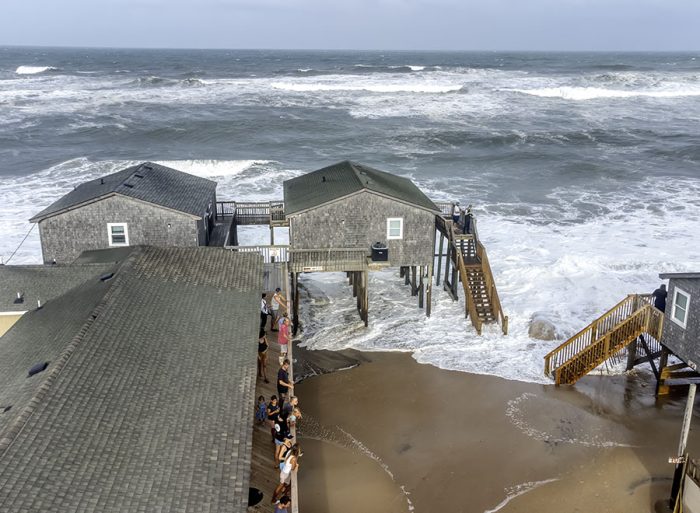
UPDATE 6:00 A.M. Wednesday evening’s high tide resulted in significant ocean overwash at multiple locations on Hatteras and Ocracoke Islands, especially north of Hatteras Village, northern Buxton, Rodanthe, Pea Island, and northern Ocracoke Island.
Standing water and ocean overwash were reported at these locations on Thursday morning, several hours ahead of high tide, which is expected to bring another significant round of coastal flooding and storm surge. The public is cautioned to avoid these areas, and stay off the roads.
N.C. Highway 12 was closed from Oregon Inlet to Hatteras due to dangerous driving conditions at 6:30 p.m. on Wednesday and remains closed as of Thursday morning.

“Conditions are too unsafe for people to be driving in,” stated the NCDOT. “If you come across any flood waters, turn around, don’t drown.”
Hatteras-Ocracoke ferry operations were suspended at 5:30 p.m. on Wednesday due to the deteriorating weather conditions, and N.C. Highway 12 is also closed on Ocracoke Island from the ferry terminal to the National Park Service Pony Pens.
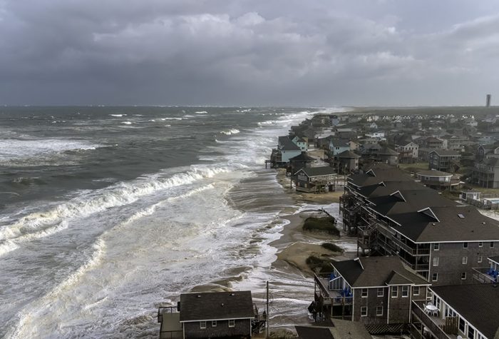
Hurricane Erin will continue to bring significant impacts to Hatteras and Ocracoke Islands on Thursday, with forecasters warning of life-threatening storm surge, dangerous surf, and prolonged coastal flooding through at least Friday.
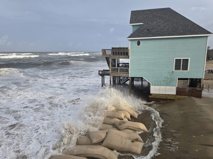
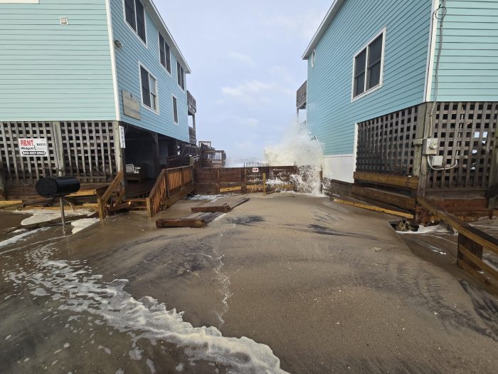
Storm surge of 2-4 feet above ground level is expected across vulnerable portions of Hatteras and Ocracoke, with higher localized inundation possible, especially for oceanside communities.
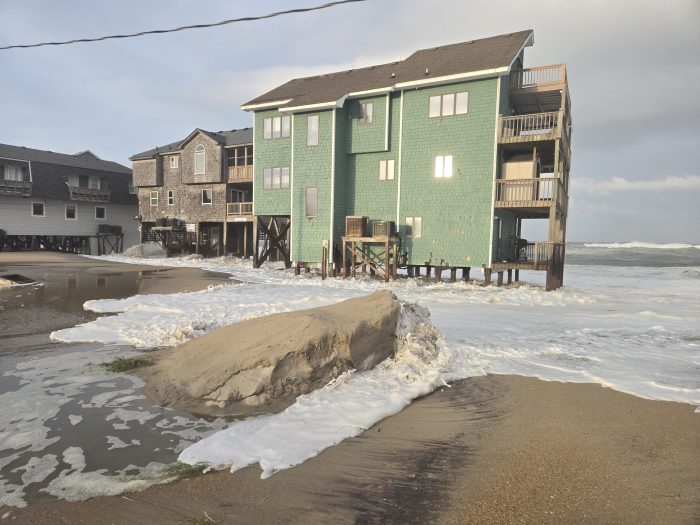
Large breaking waves of 15 to 20 feet will continue to batter the Outer Banks surf zone, producing severe beach erosion and overwash along N.C. 12 and other low-lying side roads. East-facing beaches are most at risk, and forecasters caution that oceanside flooding could render portions of the highway impassable for several more days.
Tropical storm-force winds will continue Thursday, with gusts of 60 mph or more possible along the Outer Banks. Strong north to northeast winds will also drive soundside flooding on Ocracoke, Hatteras, and Downeast Carteret County, further complicating travel and evacuation routes.
Dangerous rip currents and hazardous surf will remain widespread throughout the Outer Banks for several days, making conditions unsafe for swimming, surfing, or boating.
A Storm Surge Warning and a Tropical Storm Warning remain in effect for the Outer Banks.
Photos of Buxton on Wednesday evening by Don Bowers.


A list of local Outer Banks resources for information is below.
- For alerts and notifications from Dare County on a customizable list of events or emergencies, (including hurricane evacuations and updates), visit https://www.darenc.gov/departments/emergency-management/emergency-alerts.
- For rip current information and other beach hazards, sign up for text alerts from Dare County, ocean rescue agencies, and the National Weather Service by texting “OBXBeachConditions” to 77295.
- For real-time flood maps that show water level rises throughout Hatteras and Ocracoke Islands, (as well as optional alerts), visit the NC Flood Inundation Mapping and Alert Network.
- For information on the local forecast, visit weather.gov/mhx for general weather information, or the National Weather Service office in Newport/Morehead City’s Facebook page at https://www.facebook.com/NWSMoreheadCity/.
- For up-to-date information on tropical conditions, follow the NWS at gov/mhx/tropical or visit the National Hurricane Center’s website. Just pay attention to all info, and not just the cone graphics.
- To sign up for the Special Needs Registry for hurricane assistance through Dare County, visit https://www.darenc.gov/departments/health-human-services/special-medical-needs-registry or call 252-475-5599.
- For Dare County hurricane information, including reentry procedures, visit https://www.darenc.gov/departments/emergency-management/hurricanes.
- For updates regarding road conditions, visit DriveNC.gov and follow the North Carolina Department of Transportation and NCDOT NC 12 on Facebook. The Dare County Sheriff’s Office also shares local road condition updates on its Facebook page.
- To get notified of ferry delays or cancellations, sign up for text and/or email alerts via the N.C. Ferry System’s FINS system: www.ncdot.gov/fins.
- For up-to-the-minute local information on hurricanes, as they happen, listen to Radio Hatteras at 101.5 (Avon through Hatteras) and 99.9 (Tri-villages), or visit them online at https://www.radiohatteras.org/.
- For online news coverage on active storms, continue to check the Island Free Press.
The post Overwash reported ahead of Thursday morning’s high tide, N.C. Highway 12 remains closed appeared first on Island Free Press.

 Add to favorites
Credit: Original content published here.